May is Summer Fun Laid Back and Easy .... Traffic Calming makes it better for everyone.
Traffic Calming to Slow Vehicle Speeds
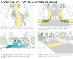
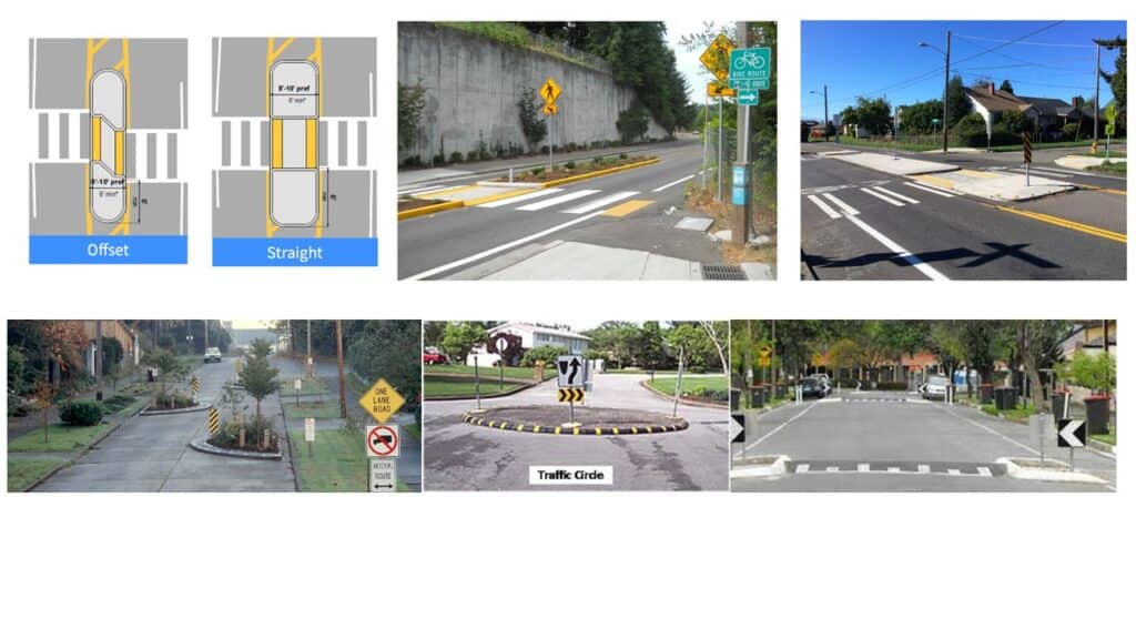
The Institute of Transportation Engineers defines traffic calming as the combination of measures that reduce the negative effects of motor vehicle use, alter driver behavior, and improve conditions for non-motorized street users. Traffic calming consists of physical design and other measures put in place on existing roads to reduce vehicle speeds and improve safety for pedestrians and cyclists. For example, vertical deflections (speed humps, speed tables, and raised intersections), horizontal shifts, and roadway narrowing are intended to reduce speed and enhance the street environment for non-motorists. Closures that obstruct traffic movements in one or more directions, such as median barriers, are intended to reduce cut-through traffic. Traffic calming measures can be implemented at an intersection, street, neighborhood, or area-wide level.
“Road diets” are one approach to traffic calming. Road diets involve a reduction in the width or number of vehicular travel lanes and reallocating that space for other uses such as bicycle lanes, pedestrian crossing islands, left turn lanes, or parking. Safety and operational benefits for vehicles and pedestrians include
- decreasing vehicle travel lanes for pedestrians to cross,
- providing room for a pedestrian crossing median,
- improving safety for bicyclists when bicycle lanes are added,
- providing an opportunity for on-street parking (which also serves as a buffer between pedestrians and vehicles),
- reducing rear-end and side-swipe crashes,
- improving speed limit compliance, and
- decreasing crash severity when crashes do occur.
Implementation of traffic calming measures can reduce traffic speed, reduce motor-vehicle collisions, and improve safety for pedestrians and cyclists. These measures can also increase pedestrian and bicycling activity.
Powell Bill Time of year, let JMTE be your Dream Team
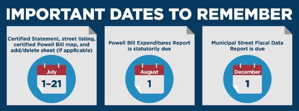
Now is the time to update your Powell Bill map!
It is never too early to think about your municipal Powell Bill map.
- Has it been 5 years since your map was updated?
- Are there changes to the roadway or were roads widened to 16 feet?
- Do you have newly paved roads or a recently added subdivision?
Powell Bill funds are used primarily for the resurfacing of streets within the corporate limits of the municipality, but can also help pay for construction, improvements, repairs, and maintenance of any street or public thoroughfare, including bridges, drainage systems, and curbs and gutters, as well as the planning, construction and maintenance of bikeways, greenways or sidewalks.
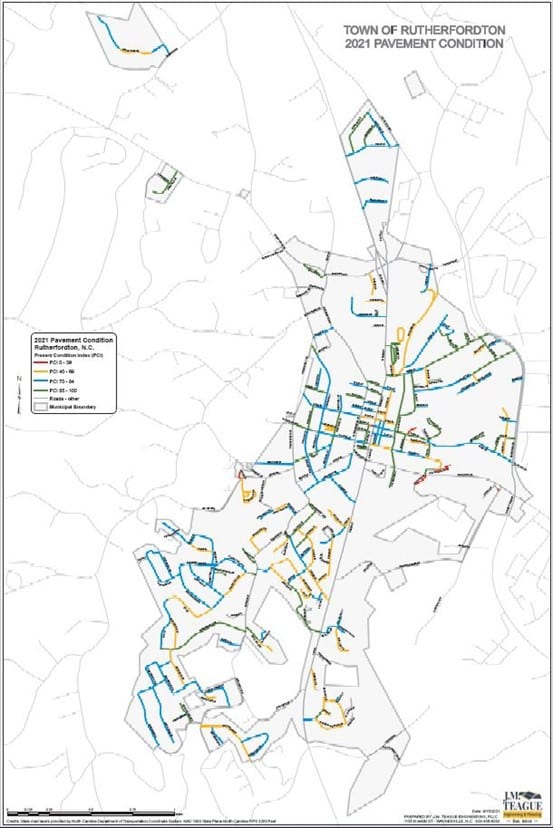
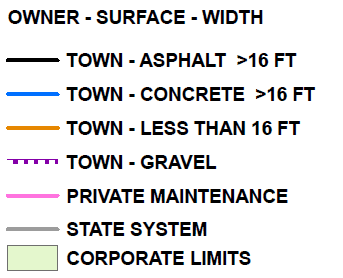
Since the State Street Program was established in 1951, each municipality establishes its eligibility annually by submitting a Certified Statement, Street Listing, and a Certified Powell Bill Map to the North Carolina Department of Transportation (NCDOT). The map is required if changes have been made to the municipalities’ corporate limits or the municipally-owned roadways. Even if no changes have been made, a certified map is still due every five years. Each municipality is also statutorily required to submit a financial statement of expenditures and revenues for the preceding fiscal year. Powell Bill maps are then used by NCDOT to reimburse roadway maintenance expenses to local governments.
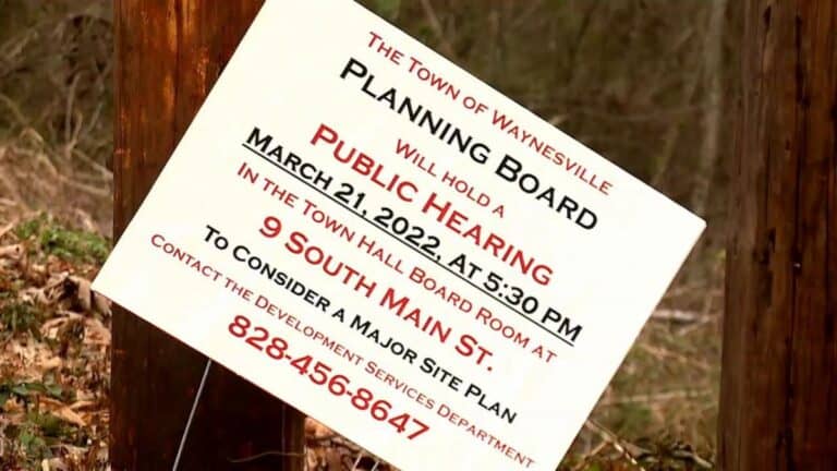
Mark Teague, P.E. Valued Counsel to Local Government Waynesville adjusts traffic impact policy to include developers early in process.
WAYNESVILLE, N.C. (WLOS) — The Town of Waynesville has clarified its traffic impact policy in the wake of several recently approved housing developments.
Until now, the impact of additional vehicles relied on the NCDOT interpreting traffic thresholds after the development is built, the town’s traffic consultant Mark Teague said. He’s worked with Town leaders to create a policy that includes a pre-submittal meeting with developers.
“Where the applicant and the town meet ahead of time to really look at what needs to be studied, the parameters, all the assumptions that go into a traffic study,” Teague said.
Mr. Teague said he’s worked with Town leaders to establish their desired traffic thresholds and where mitigation should be required for new developments. He said the new policy clarity will benefit the town board and developers.